
[ENG/ESP] Recreation of the work trip: Moa-Sagua-Baracoa Mountain Group
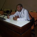


Below, I present a recreation of the work trip we took, whose main objective was to characterize the essential elements of its geography and assess the economic potential of the area.
General Geography


The massif has an east-west orientation with an approximate length of 187 km and an average width of nearly 50 km. Its terrain comprises plateaus, mountain ranges, karst hills, and interspersed valleys. The varying altitude and proximity to the sea create a wide variety of microclimates in the area.
The mountain system includes several prominent ranges and peaks such as Sierra Cristal, Cuchillas de Moa, and Pico Cristal, the highest point in the region.


Vegetation
The massif is notable for its high biodiversity and endemism. Within just 7% of Cuba's land area, it encompasses all 23 landscape types found throughout the archipelago, representing the greatest diversity of landscapes and vegetation types in the Caribbean islands.


Hydrography
The massif is an important watershed for eastern Cuba and contains the headwaters and upper reaches of significant rivers. It holds three of the most important watersheds in the country.
The region is considered the area with the greatest biodiversity in Cuba, with approximately 68% of the country's species, and has been recognized as a biodiversity hotspot. The Alejandro de Humboldt National Park, part of which is located in the mountain range, has received international recognition for its biological value.


Geology
The geology of the massif is heterogeneous:


The ultrabasic rocks generate soils with high metal content and low fertility for many species, which has fostered specialized plant communities. The carbonate formations have given rise to mogotes, caves, and dolines characteristic of the karst landscapes of eastern Cuba.


Rocks and Minerals: Uses in Goldsmithing and More
The Moa-Baracoa region contains the largest ophiolitic chromite deposit in Cuba, with reserves exceeding 1,000,000 tons. The chromite deposits are located in the transition zone between the mantle and the Earth's crust. They can be grouped into three mining districts according to their composition.
After finishing our research, guided by a friend from the nearby village, we ventured into the limestone foothills of Baracoa, until we came upon the entrance to a karst cave well known to the locals.
Inside, rainwater, filtered for centuries through layers of limestone and dolomite, had sculpted a veritable underground sanctuary. We left our backpacks on the bedrock and submerged ourselves in this embrace of fresh water. It was cold, but not freezing; the perfect temperature to close our pores after the stifling heat of the mountains.


In that same place, and as the grand finale to our trip, we roasted a pig in the purest tradition of eastern China, which we thoroughly enjoyed.


That swim turned out to be the best of all the treasures we took away from the trip. It was the refreshing, cool moment that sealed our journey through the Moa-Sagua-Baracoa region, a mountain shower that reminded us that, in the end, all that harsh, mineral-rich geology exists to protect and give life.


This working trip through the Moa-Sagua-Baracoa mountain range reveals a territory of exceptional natural and geological richness. Its landscapes combine the majesty of its peaks (such as Pico Cristal at 1,231 m), the exuberance of its forests (home to 68% of Cuba's biodiversity), the hydrological importance of its rivers (especially the Toa, Cuba's largest river by volume), and a geological and mining heritage that includes chromite, gold, platinum group minerals, and valuable ornamental rocks.
Note: The images are my own.
I used DeepL Translate.
ESPAÑOL
El Grupo Montañoso Nipe-Sagua-Baracoa (también conocido como Moa-Sagua-Baracoa) es un sistema montañoso situado en el extremo nororiental de Cuba, que abarca principalmente partes de las provincias de Holguín y Guantánamo, y una porción del noreste de Santiago de Cuba. Se extiende longitudinalmente desde las proximidades de la bahía de Nipe hasta el cabo Maisí.

A continuación, te presento una recreación del viaje de trabajo que hicimos, cuyo objetivo esencial fue caracterizar los elementos esenciales de su geografía y valorar las potencialidades económicas del lugar.
Geografía General
El macizo tiene una orientación este-oeste con una longitud aproximada de 187 km y una anchura media cercana a 50 km. Su relieve comprende mesetas, sierras, mogotes kársticos y valles intercalados. La variación altitudinal y la proximidad al mar condicionan una gran heterogeneidad de microclimas en el área
El sistema montañoso integra varias sierras y elevaciones destacadas como Sierra Cristal, Cuchillas de Moa y el Pico Cristal que es la máxima altura de este lugar.

Vegetación
El macizo destaca por su elevada diversidad biológica y endemismo. Alberga en solo el 7% de las tierras cubanas los 23 tipos de paisajes que existen en el archipiélago, lo que constituye la mayor diversidad de paisajes y tipos de vegetación de las islas del Caribe.

Hidrografía
El macizo es una importante cuenca hidrográfica para el oriente de Cuba y alberga los nacimientos y cursos superiores de ríos relevantes. Atesora tres de las más importantes cuencas del país.
La región es considerada la zona de mayor biodiversidad de Cuba, con alrededor del 68% de especies, y ha sido reconocida como punto caliente de biodiversidad. El Parque Nacional Alejandro de Humboldt, parte del cual se localiza en el macizo, ha recibido reconocimiento internacional por su valor biológico.

Geología
La geología del macizo es heterogénea:


Las rocas ultrabásicas generan suelos con altos contenidos de metales y baja fertilidad para muchas especies, lo que ha propiciado comunidades vegetales especializadas. Las formaciones carbonatadas han dado lugar a mogotes, cuevas y dolinas característicos de los paisajes cársicos del oriente cubano.
Rocas y minerales: usos en orfebrería y más
La región de Moa-Baracoa contiene el yacimiento de cromita ofiolítica más grande de Cuba, con reservas superiores a 1.000.000 de toneladas. Los depósitos de cromita se localizan en la zona de transición entre el manto y la corteza terrestre. Se pueden agrupar en tres distritos mineros según su composición.
Después de terminar nuestras tareas de investigación guiados por un amigo del poblado cercano, nos adentramos en las estribaciones calcáreas de Baracoa, hasta dar con la boca de una gruta cársica que los lugareños conocen bien.
En su interior, el agua de lluvia filtrada durante siglos a través de las capas de calizas y dolomías había esculpido un verdadero santuario subterráneo. Dejamos las mochilas sobre la roca viva y nos sumergimos en ese abrazo de agua dulce. Era fría, pero no helada; la temperatura perfecta para cerrar los poros después del sofocante calor de la serranía.
En ese mismo lugar y. como colofón a nuestro viaje asamos un cerdo a la más pura tradición del oriente del país que mucho disfrutamos.
Ese baño resultó ser el mejor de todos los tesoros que nos llevamos del viaje. Fue el broche de agua dulce que selló nuestro recorrido por el grupo Moa-Sagua-Baracoa, una ducha de montaña que nos recordó que, al final, toda esa geología tan dura y mineral existe para proteger y regalar vida.

Este viaje de trabajo por el grupo montañoso Moa-Sagua-Baracoa revela un territorio de excepcional riqueza natural y geológica. Sus paisajes combinan la majestuosidad de sus picos (como el Pico Cristal con 1.231 m), la exuberancia de sus bosques (con el 68% de la biodiversidad de Cuba), la importancia hidrológica de sus ríos (especialmente el Toa, el más caudaloso de Cuba) y un patrimonio geológico-minero que incluye cromita, oro, minerales del grupo del platino y rocas ornamentales de gran valor.
Nota: Las imágenes son de mi propiedad.
Utilicé el traductor DeepL Translate.
Interesante paseo de trabajo y recreativo. Me encantó que mostraras esos detalles del macizo, una formación rocosa impresionante, me llamó la atención la estructura de algunas rocas. La naturaleza es sorprendente. Siempre es agradable leer tus post pues tienen información muy valiosa. Saludos, amigo.
Muchas gracias por tus palabras estimada amiga.
Si, la naturaleza es caprichosa y sabía. En todos estos años he visto formas variadas de rocas y estructuras de montañas que no creería que existieran si no las hubiese visto. Feliz domingo y muchas gracias por compartir tus criterios. Salud y saludos.
Hello! Thank you very much for posting on the Worldmappin Community. We would like to remind you that one of the rules of our community is to pin your post to our map. This will give your post more reach, as well as have the chance to be featured in our daily Travel Digest 😃.
Quick guide on how to do it.
1 - Go to https://worldmappin.com
2 - Find the location of your publication on the map, you can do this by scrolling on the map or using the search bar.
3 - Click on the GET CODE button and then click on the exact location of your publication: a code snippet will be generated.
4 - Copy the code and paste it into the draft of your Hive post. Then publish it :)
The code will be invisible in your post, but a few minutes after publishing you will receive a comment informing you that your post has been added to the map.
Or you can directly pin your post to the map via PeakD. After drafting your post, click the map icon at the bottom. It's beside "Short preview description" and above the "Advanced" icon.
We suggest you read all the rules of our community here.
For any other questions, don't hesitate to contact our team on our Discord channel.
Cheers!
Hello to all the members of the @worldmappin team.
In each of my posts, I write the code at the end – or, as in this case, the codes. I don’t know what I’m doing wrong, because in the draft I can see the codes for the places I’ve visited.
Have a lovely weekend.
Best wishes and regards.