JOURNEY TO PANTAN TERONG // The challenges of passing through the hilly roads and the beautiful views along the roadside.
Good night to all my beloved hive friends ♥️

In this post, I will share an exciting experience and memorable moment that I had while traveling to an old tourist destination in Central Aceh. Even today, many visitors still come flocking to this place — not because they are afraid of missing out, but because this is a place where we can truly witness and feel how extraordinary nature is.
The beautiful natural scenery can already be seen even from the roadside. However, reaching this tourist destination is not an easy thing, because we have to pass through an extremely steep uphill road,in fact, even buses are not recommended to take this particular route.
I have tried to capture this moment starting from Bireuen City.


I made this journey at 6:00 in the morning, when the surrounding atmosphere was still calm and cool, and the roads were not too crowded, so I could travel more quickly and relax. Oh yes, I went on this trip together with my partner, and we also share the same hobby, which is traveling.
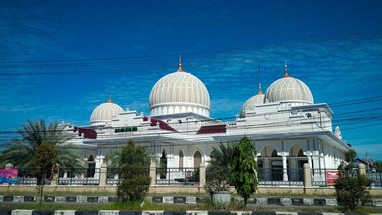
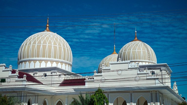
To perfectly capture the moments from this journey, I was willing to stop at several places to photograph various objects and beautiful scenery. I also managed to capture a fairly magnificent mosque in Bireuen City from the roadside, although unfortunately I did not have enough time to explore it further.


After traveling for about an hour from the center of Bireuen City, I finally arrived at a natural tourist destination called Krueng Simpo. I tried to capture the scenery of this tourist spot from the roadside, and we can see its current condition now.
In the past, this place was one of the most popular natural tourist destinations in Bireuen,however after the floods struck Aceh a few months ago, many tourist attractions were damaged, including this one,even so, the place is still quite crowded with visitors and has not been abandoned.


This is one of the reasons why I really like traveling to Central Aceh, there are so many beautiful natural views that we can see along the way. Central Aceh is also located on high ground, so there are so many natural views that we can find and see there, and if I have enough time I will definitely capture those beautiful natural views.

My destination this time was a tourist attraction located on a mountain peak, and the journey to get there was quite difficult,it was not because of the distance, but the route was extremely steep. If I’m not mistaken, the distance between Takengon city and this tourist destination is only around 7 kilometers,that is actually not a long distance, but it becomes a different story when the road is constantly uphill.

To get to this tourist spot, we also have to pass through several villages in Bebesan sub-district, the road continues to climb so I was surprised when I had the chance to look back.


Because the natural scenery was so beautiful, I decided to stop for a moment on the side of the road,I don't know exactly how high this area is, but one thing is certain,the tourist destination I was heading to was still quite far away and was still quite high on the mountain peak. Even from this point,I could already clearly see the stunning scenery below me,vast stretches of nature filled with lush green trees and houses surrounded by beautiful landscapes,of course, it was an incredibly breathtaking view.


After continuing my journey for about another 300 meters, I was even able to see the scenery of Takengon city and tawar sea from a distance, although the view was still not completely clear.
Life is a responsibility
Be yourself, keep learning and don't hesitate to start😉
If you like other travel posts, you can see them on
Worldmappin Community and you can also participate there.
If you are curious about the places I have visited so far, you can see them on my personal worldmappin map
And you can also find me on Ecency Discord
Thank you very much for reading my post till the end, I am here to say thank you very much
🙏
All images are mine, I took the photos using the Infinix 10 pro cellphone and I edited the images using the Lightroom application.
I'm @riyat. See you again in my next post
♥️

You can check out this post and your own profile on the map. Be part of the Worldmappin Community and join our Discord Channel to get in touch with other travelers, ask questions or just be updated on our latest features.
Thank you very much ♥️🙏
This looks like an amazing trip, my friend! The view from the top is absolutely stunning. Driving through those steep hilly roads must have been quite an adventure. Great photos, by the way.🌹🌹🌹🌹❤️
Glad you like it .Thank you very much for your support and kind comments my friend 🙏
Congratulations on completing today's Ecency QUEST!
Curated!
Good evening Mom
Thank you very much for your support, I really appreciate it.
Have a nice day ❤️🙏
You do so much! Here is an additional tip!
Hiya, @gabrielatravels here, just swinging by to let you know that this post made it into our Honorable Mentions in Travel Digest #2935.
Your post has been manually curated by the @worldmappin team. If you like what we're doing, please drop by to check out all the rest of today's great posts and consider supporting other authors like yourself and us so we can keep the project going!
Become part of our travel community:
Good evening my friend @gabrielatravels
Thank you very much for choosing my post, I really appreciate it.
Have a nice day 🤗🙏